Through interdisciplinary cooperation between technology and crop production, products and services are developed that offer solutions to tackle the current challenges of agricultural businesses. We advise you not only on the technical implementations, but show you how to apply your resources in the field.
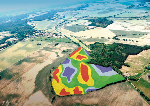
By evaluating satellite images, your areas are divided into high and low yield zones. You can opt to react to the current situation of your crops through biomass maps or by using the management zone map (MZK), which shows you the long-term yield potential of your fields. The MZK analyses your fields for recurring stable patterns and allows you to respond individually to your field characteristics even before sowing. Seed strengths can be adapted not only to the different soil types but also to the yield potential of the respective subplots. You can also increase your efficiency by applying fertilizers and plant protection products according to the yield potential. The results are shown in stable (additional) yields as well as in an even balance.
Additional modules
In addition to solutions for "crop management", we offer you further modules, such as basic fertilization or ripening information. Improve your nutrient management and always keep an eye on the right harvest time.
By bundling extensive expertise and practical experience in all area levels, AGRAVIS Digital GmbH is unique in your field and offers you tangible benefits. - Convince yourself and benefit from our innovative services!